18.2km, 980m total ascent (return) – 656m ascent on way in, 324m ascent on return.
This was an opportunity to catch up with our eldest son Jack, aged 26, during his second week of hiking north along the Australian Alps Walking Track (AAWT). Jack had set off from Walhalla in early February with a personal goal to reach Mt Kosciuszko. This would take him a total of 3- 4 weeks, covering a distance of approx. 450 kilometres. It can get lonely on the AAWT after days of not seeing a soul in remote areas, and I knew Jack wouldn’t mind some company for a day. It was also an opportunity for me to explore some parts of Victoria’s most scenic and remote high country
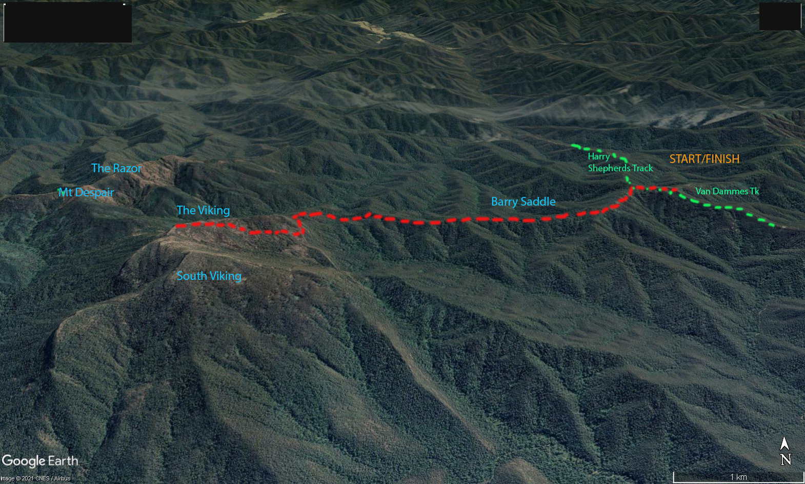
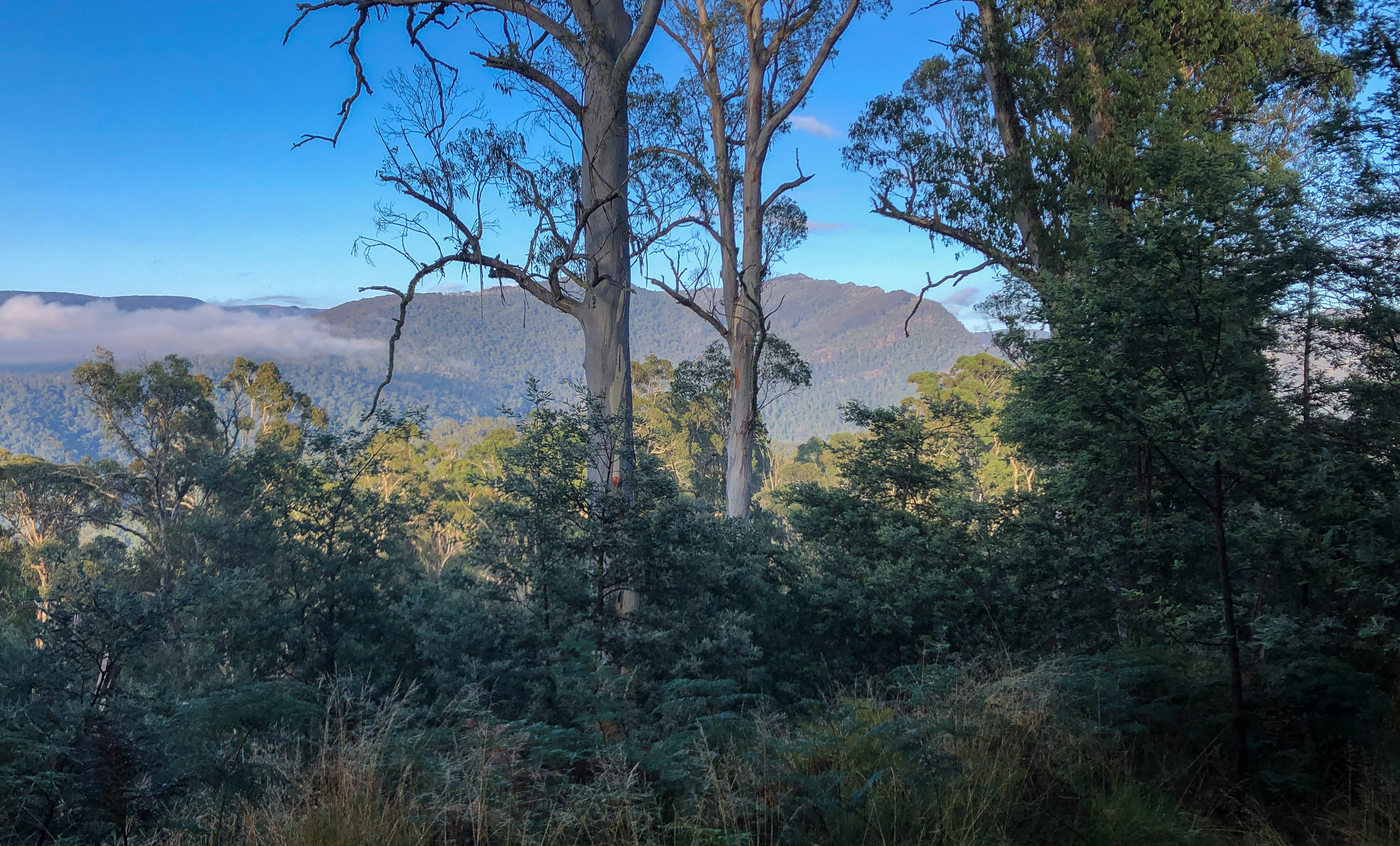
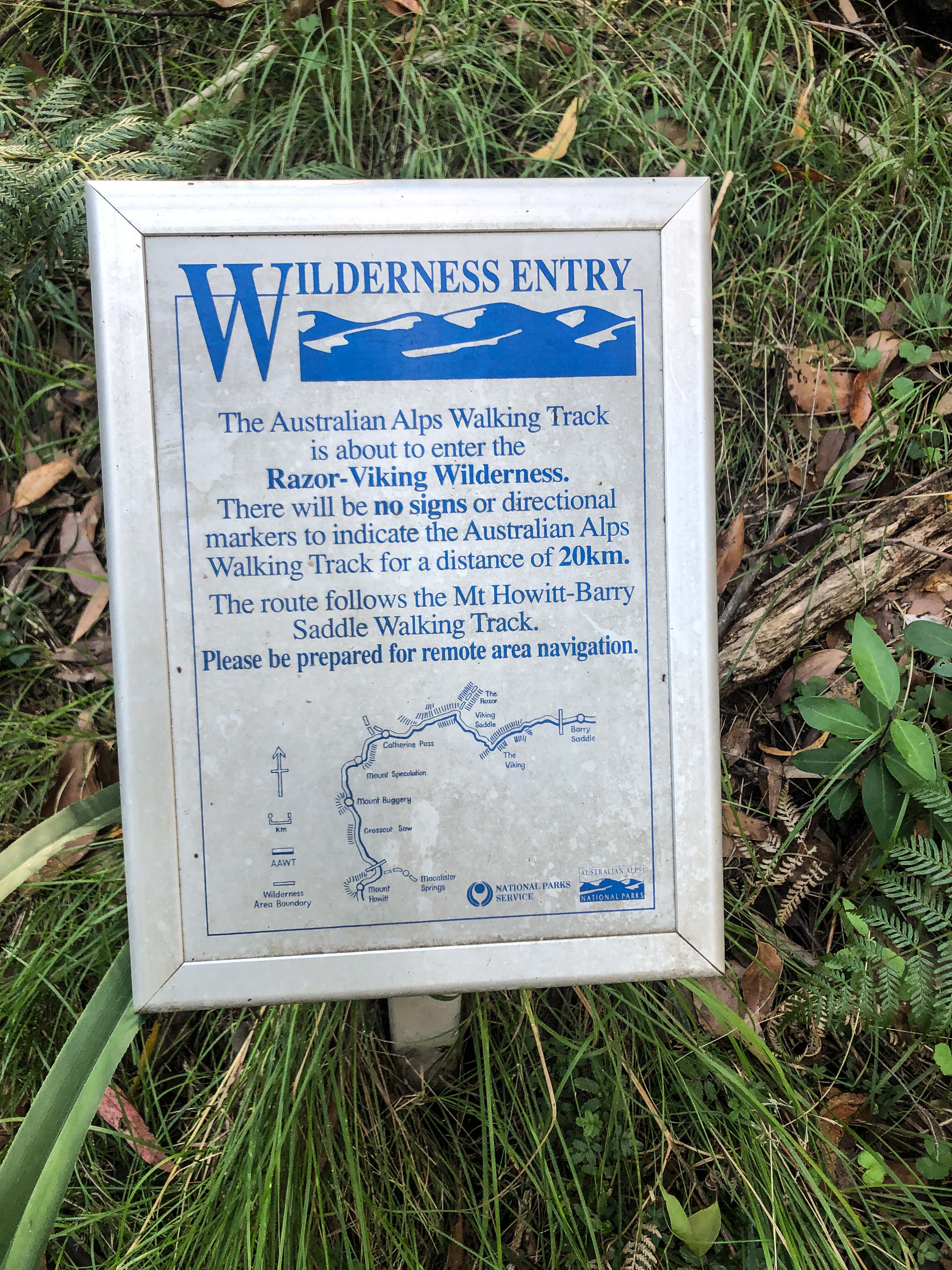
At 7am on that Sunday morning, as Jack was leaving Camp Creek at Mount Speculation, I was leaving Van Dammes Track from the east. We would head towards each other and planned to meet at the top of The Viking around midday. We would be walking in the Razor-Viking Wilderness, part of the Alpine National Park, and without prior local knowledge we could only guess the condition and difficulty of the track. As it turned out the section that I was on had been recently cleared, whereas the section that Jack had to negotiate from Mount Speculation was in much worse condition.
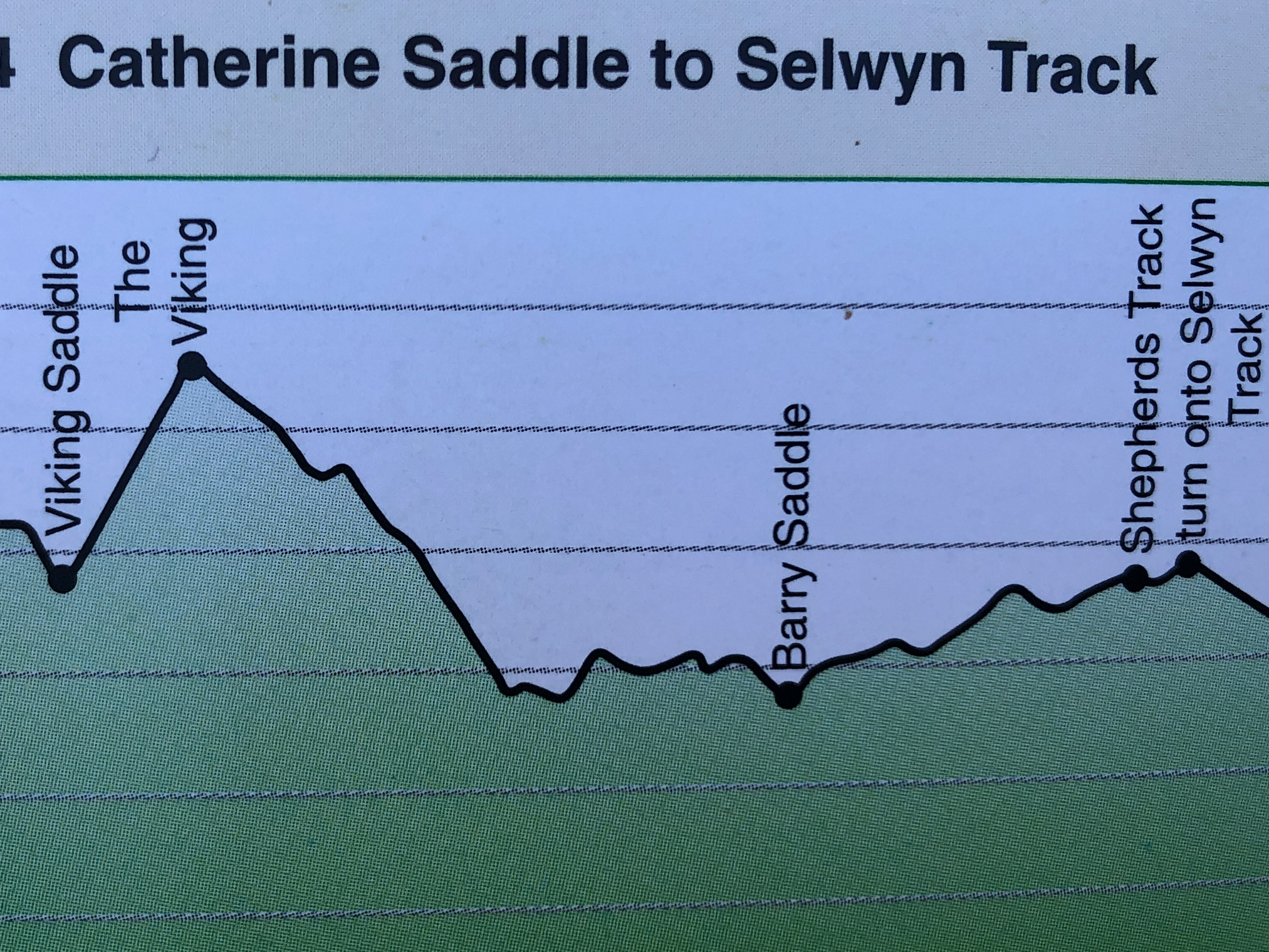
I slept the night before in my swag at the parked car on Harry Shepherds Track junction with Van Dammes Track. It was my intention to walk the nine kilometres to the top of The Viking in about 5 hours. We both had a Garmin InReach Mini for communicating via text message. The February weather was perfect with a nice forecast top temp. of 20 C. As the AAWT guide suggested walkers doing this section camp at Barry Saddle, which was 3.75 km from my car (and about 17km for Jack), I carried my pack as far as Barry Saddle before offloading the tent, sleeping bag and some other items, which I would use, or collect, on my return. Because I was spending a day walking in the Wilderness I carried adequate clothing, water and other gear in event of a weather change or an unforeseen situation. Jack was walking the traditional AAWT direction from south to north.
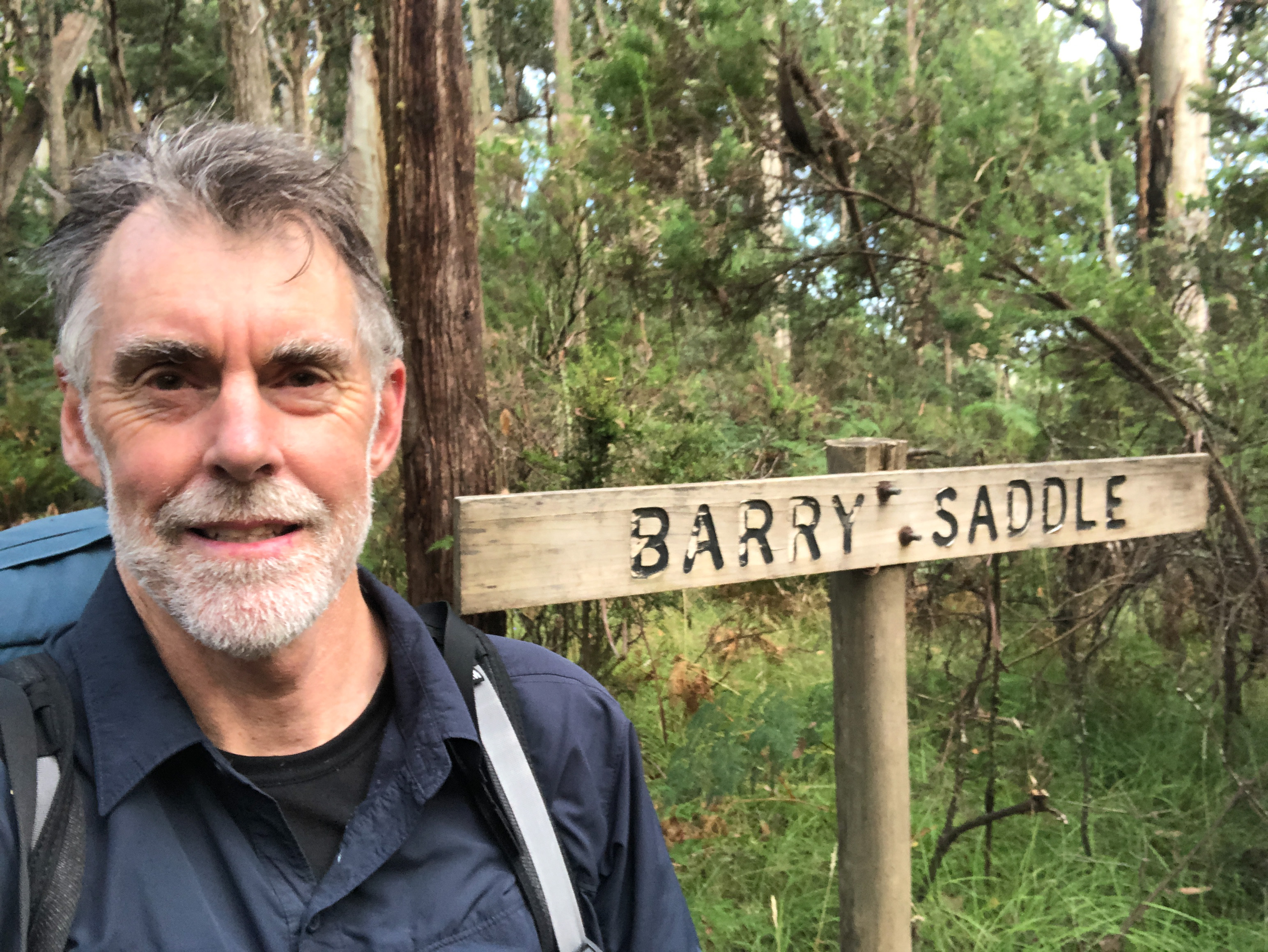
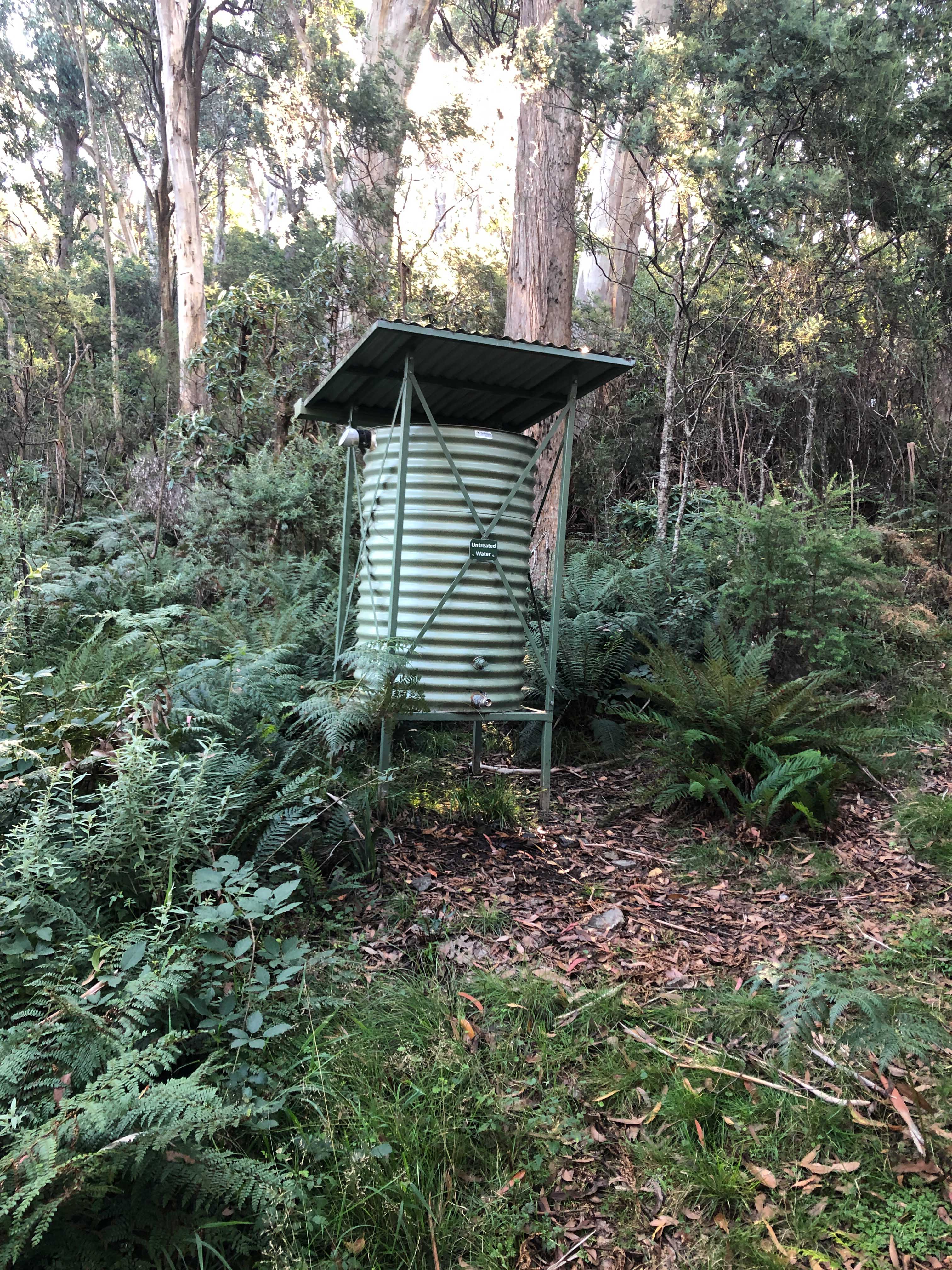
The 3.75 km from Harry Shepherds Track to Barry Saddle was along a nicely maintained and cleared Management Vehicle Track. It was obvious that Parks Victoria staff periodically used this section of track for vehicle access to the camping area. The Barry saddle camping site also had provision of water in the way of a recently constructed roofed rain water tank. This was one of a number of water tanks to provide walkers with drinking water en-route across the dry Barry Mountains.
I entered my name in the log book and continued walking. For the next three kilometres there were a series of small saddles, similar to the first 3.75 km to Barry saddle.
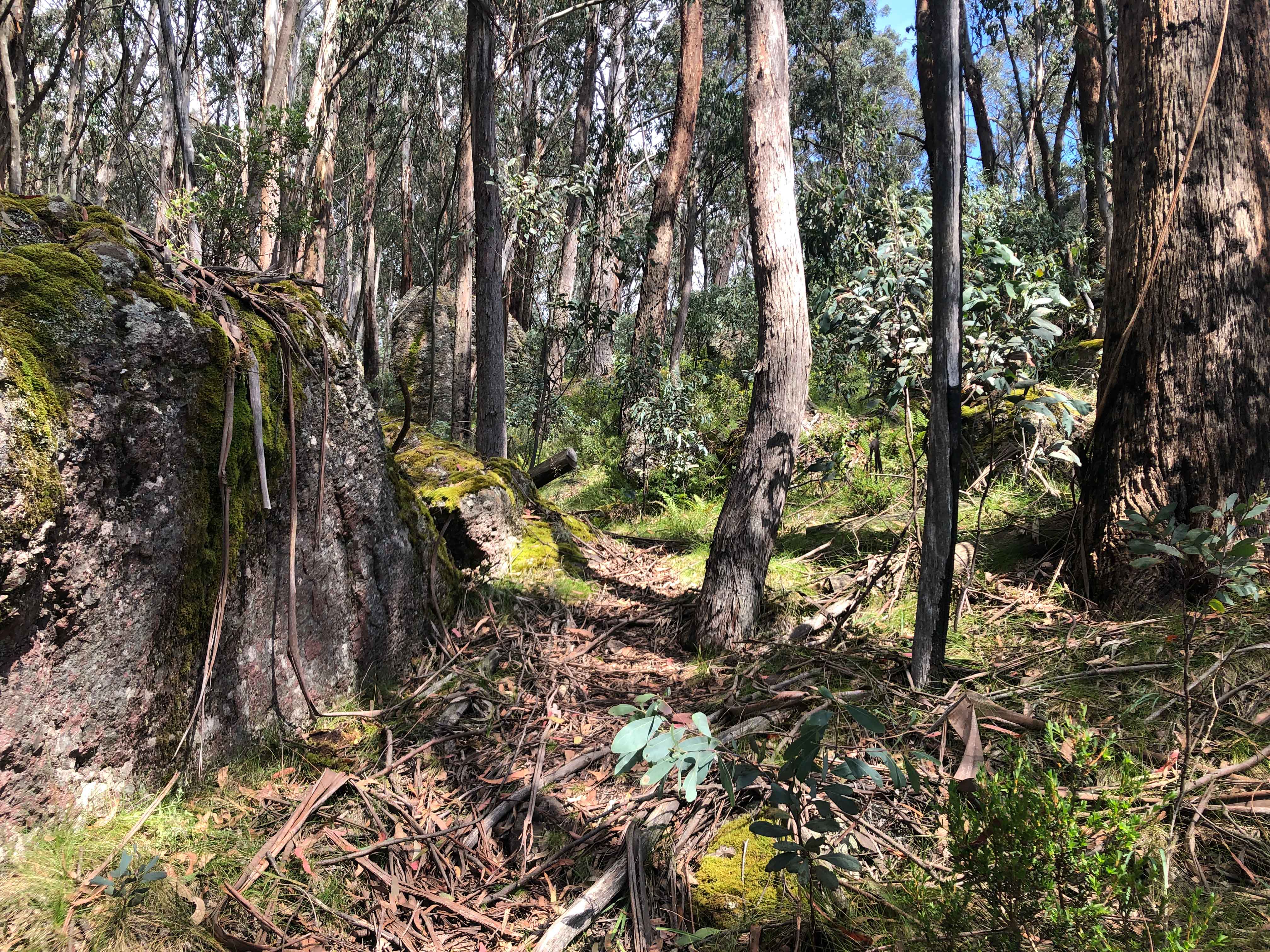
It appeared that Parks Victoria used a small machine to clear vegetation along this easy gradient section of track as it was nicely cut and cleared to a couple of metres width. The footprint was slightly larger than a normal narrow width track. Any initial unsightly impact of works would have quickly disappeared due to the vigorous regrowth of the vegetation. This mechanical method would have been more cost effective and practical than manual clearing.


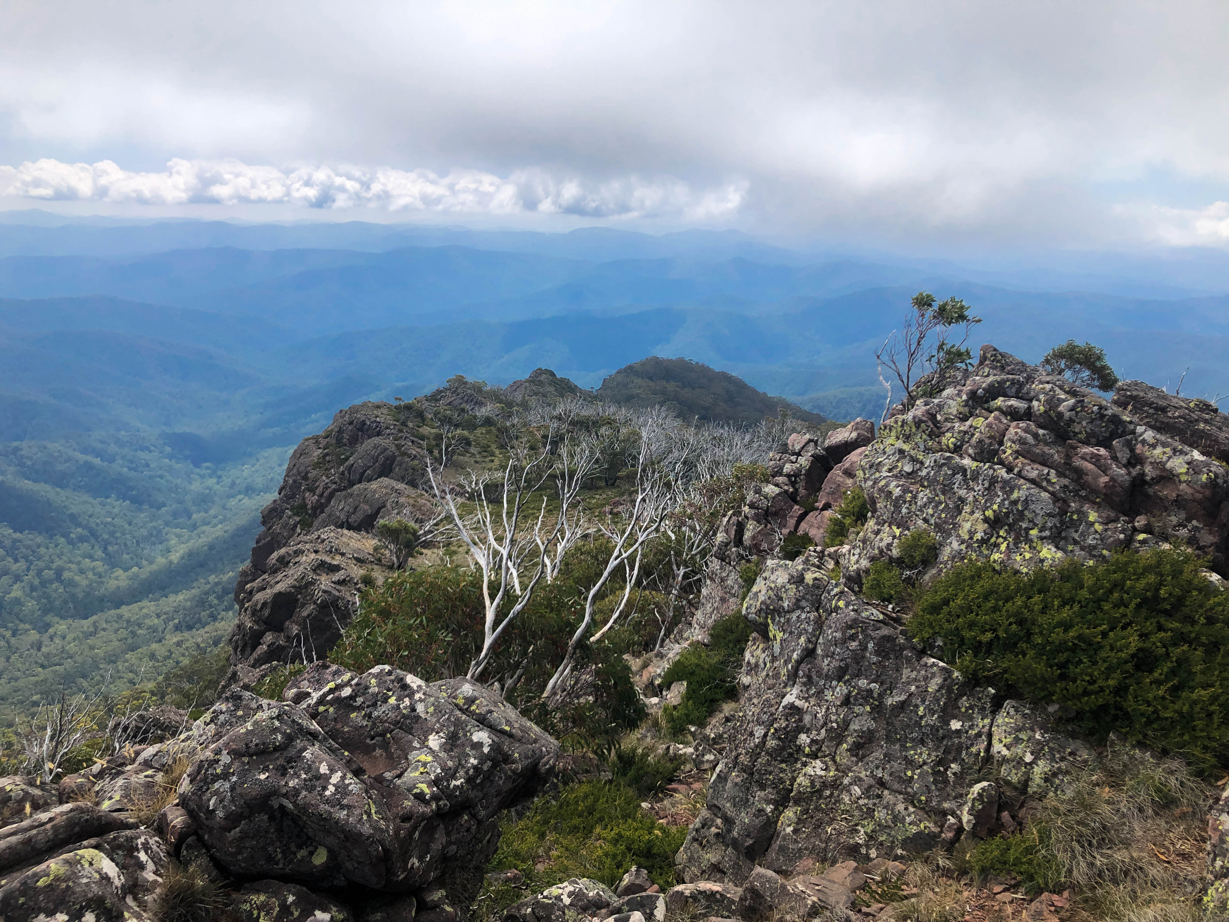
At about the 6km point the track changed from an undulating steady gradient to a steep climb up The Viking. It was quite arduous climbing the 45 degrees slope of The Viking eastern face. The track twisted itself around boulders, rocks and trees on its way to the top. I was soon working up a sweat as I climbed the 500m ascent.
It was however pleasing to see that, consistent with the first bit of this section, all trees and branches had been cleared. My guess is that this would have been carried out by a work crew on foot armed with chainsaw – in the past 12 months. This level of maintenance was completely unexpected after hearing first hand from Jack about the large amount of fallen trees, branches and undergrowth on other sections of the AAWT track, in particular with the section between Mount Speculation and The Viking.
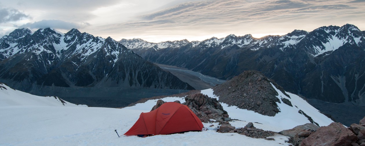
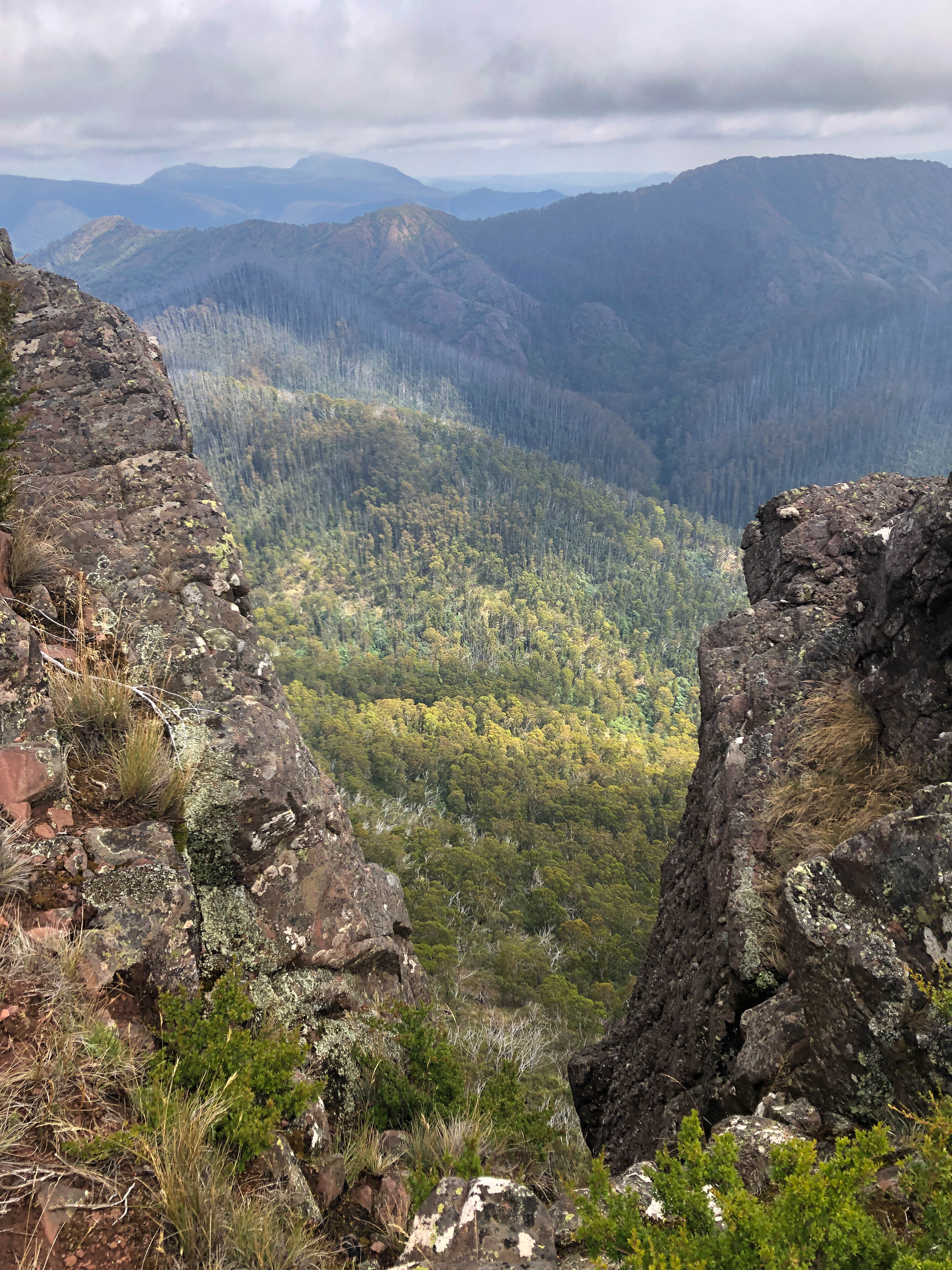
After walking for five hours, which included a few stops for cooling down, I was at the top of the Viking (1508m), taking in the commanding views of the Crosscut Saw and Mt Speculation to the west, and Barry Mountains to the east. There was mobile phone reception so I was able to read Jack’s track log on Garmin MapShare after sending a message using inReach letting him know where I was. Jack arrived at 1.45pm. Although covering a similar distance to me, he was confronted with numerous tree trunks and branches.
There were a few short sections where the track was overgrown. Alpine Oxylobium, a native species around a metre in height is common at the higher altitudes, which characteristically spreads across any track forcing oneself to have to push through its dense foliage.


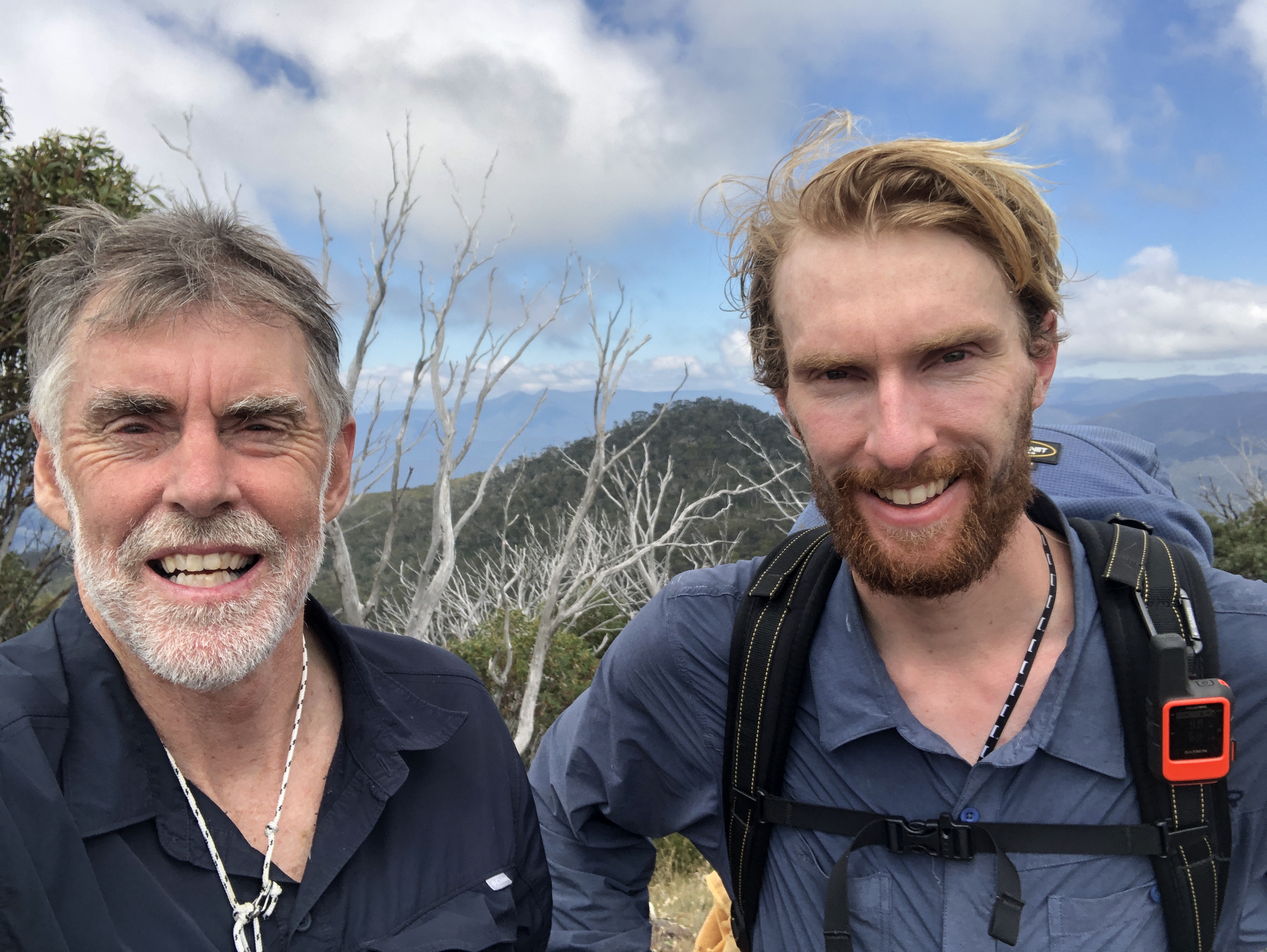
We brewed a cuppa, had some lunch and then proceeded back the way I had come. After stopping at Barry Saddle to replenish our water bottles and collect my tent and other gear we walked the remaining 3.5 kilometres to my car, arriving just after 7pm. We camped the night. Jack continued on his walk to Kosciuszko the next morning.


The standard of the AAWT varies a lot. It must depend on land manager resourcing priorities, and amount of focus by park staff, and also the amount (or lack of) use. It was very fortunate for me to walk a section of the AAWT that had been given exceptional attention! How lucky was I. In some state forest areas to the south, trying to follow the AAWT is apparently more like bush orienteering than hiking.
This walk has spurned me on to do the multi day Viking Circuit. Unlike most that do it in three days I think I’d break it up into four days. Walking from Camp Creek to the Wonnangatta River is a long day. There is a flat spot for camping near the top of The Viking, about 100m on the track towards Barry Saddle which will break up the second day. The only drawback is that water is particularly scarce around the Viking, and a portion of the Viking Circuit is on unmarked tracks.
As I am writing this Jack is nearly at Mt Kosciuszko. He is looking forward to stopping and having a much deserved rest. Jack’s feet are sore with the odd blister, and other parts are hurting, but I would say that he’s now fitter than ever before. It will take many weeks of home cooking to replace the lost kilo’s. This has been a massive undertaking for Jack, with weeks of planning and organising. Part of his preparation was to deliver food drops in advance at predetermined locations, as there are virtually no opportunities, apart from Mount Hotham, to re-supply along the way. A fantastic achievement and amazing effort by Jack.

Greg this is as always such a fabulous account of your catch up trek with Jack .
What an adventure he is having .
And he is so fortunate to have had your and Margies help and expertise (esp yours) to help plan this major undertaking .
No doubt Karl Thwaites has done his bit as well .
Oh to be so fit and have the courage for such an undertaking .
He has the great example of seeing you do the near impossible .
Bass Straight .
It must be awesome as well as exhausting at times , but so deeply satisfying and give one a great sense of achievement.
You write so well on these adventures that l hope one day to hold a book in my hand about your many varied expeditions treks and of course reread about The Crossing !!
Well done.
Looking forward to seeing you for your and Annie’s birthdays .
Lots of love ,
Kes ❤👍👀👏🏾🥾🏕
LikeLike
Thanks for your kind words Kerry
LikeLike