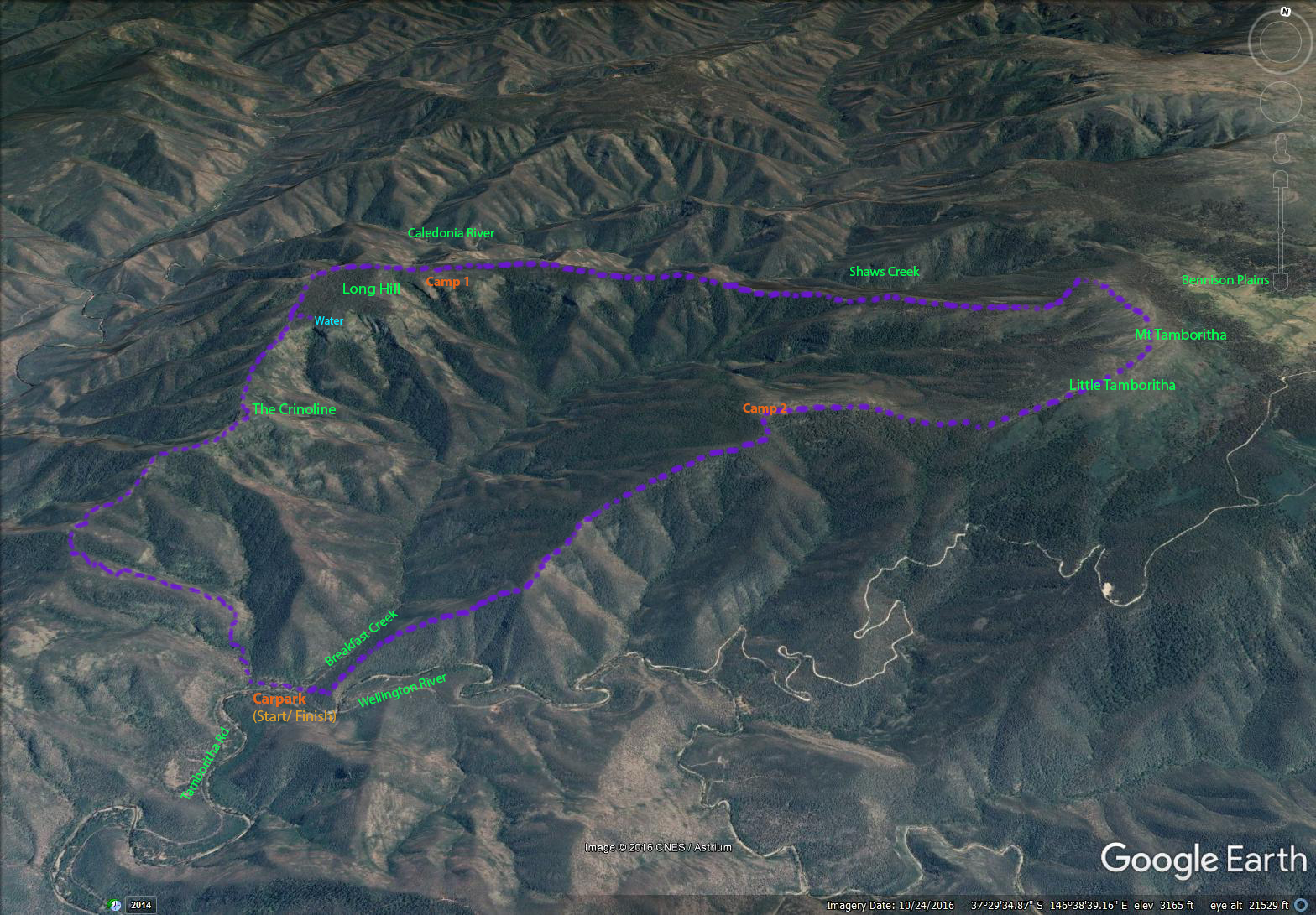
40.3km, 2180m total ascent.
After descending the final 900 metres on the third day I had finally completed this walk – this was my second attempt. Two weeks earlier I set out to do this walk with Margie, however we were forced to turn back on the second day after it proved harder than expected and we weren’t equipped with water bladder/bags to carry sufficient water. See previous blog (Long Hill via The Crinoline – October 2016).
I was keen to try this walk again and tick it off before the end of spring as I knew with summer fast approaching it would become even harder to find water and with the warmer weather you can’t walk far without water. This time Margie was happy for me to set out by myself. The main addition to my pack was a Sea to Summit 10Ltr water bladder.
DAY 1
I parked at the Breakfast Creek carpark, Tamboritha Road at 10am and had a steady climb to The Crinoline. This was good work out as the elevation went from 340m to over 1100 metres. A few times that morning I could hear a wild dog/dingo howl from the opposite ridge. This primeval sound made me think about the hardships of animals such as dogs surviving in this country and was one of the moments I love when walking in more remote parts of our bush.
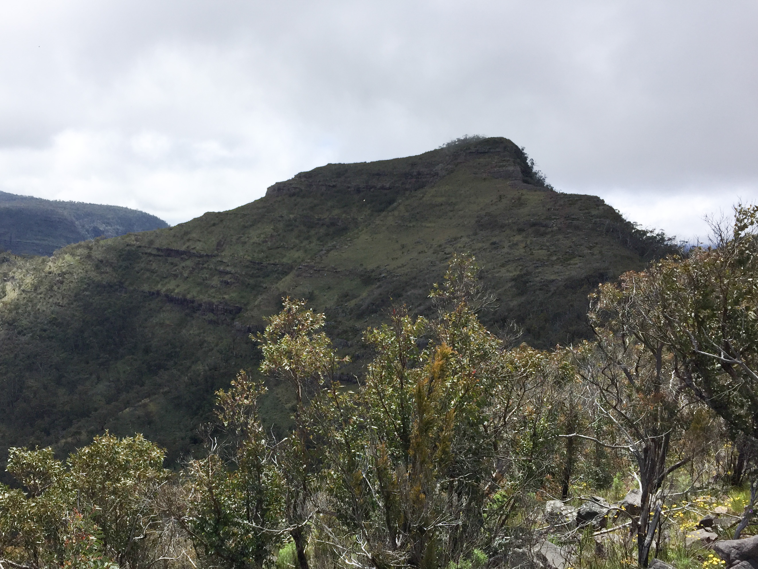

After a brief stop at The Crinoline I continued onto Long Hill. During the final few kilometres my thoughts were focussed on whether I would find water in Long Hill Creek? I’ve heard that during summer this creek completely dries up which is a real issue as it is a time and energy consuming walk to lower elevations to find water. If the creek could not provide me with water my three day circuit trip was over. Two weeks ago I could see water dropping over the falls from a good distance but this time was different. However when I got within a few hundred metres of the falls I saw a small shower. I was instantly relieved and knew that virtually nothing could now stop me from completing the walk.

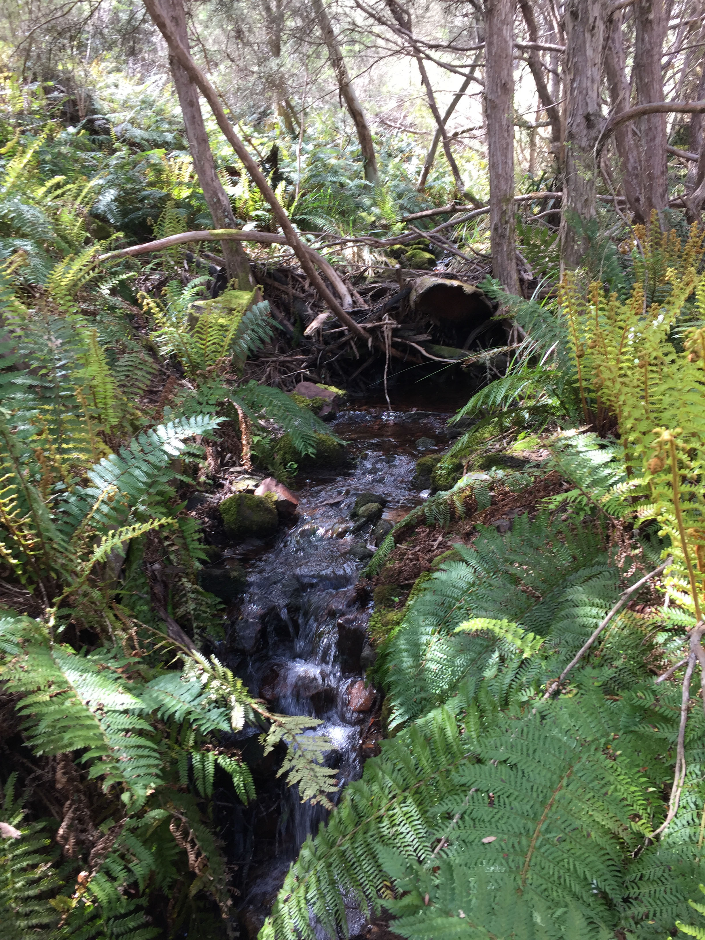
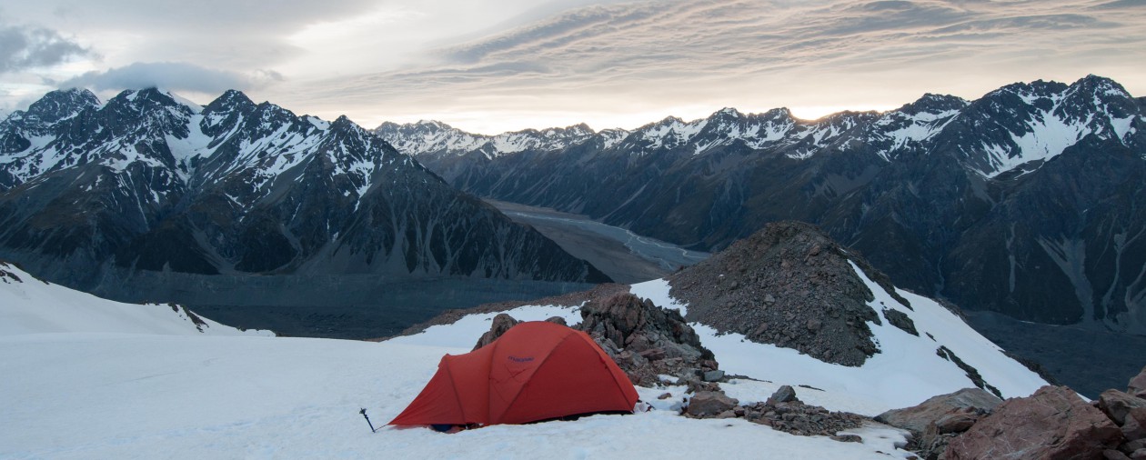
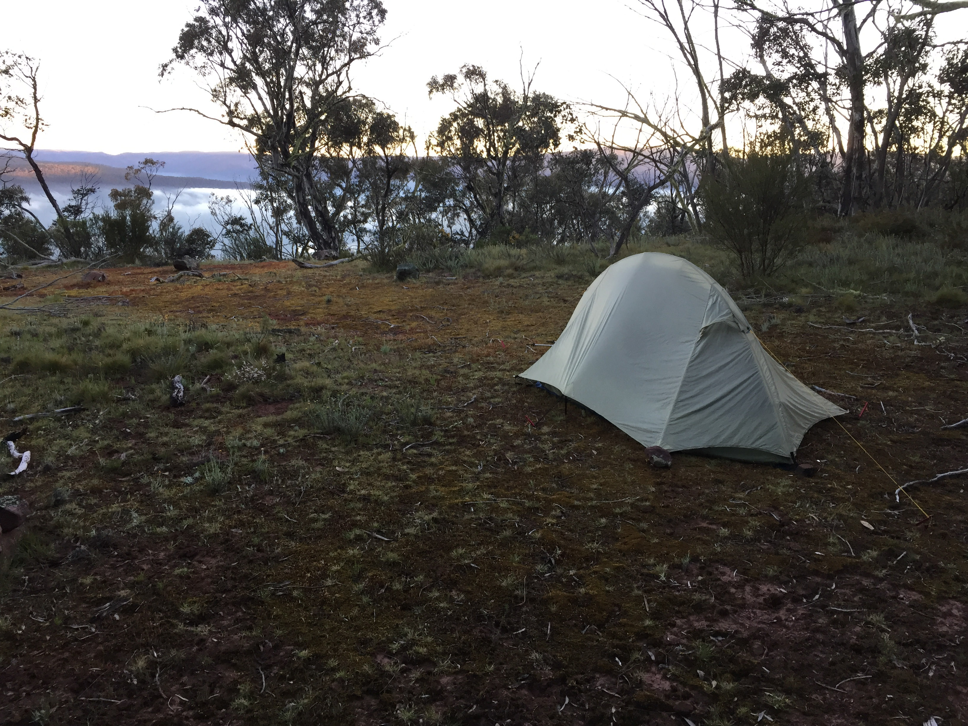
After pouring 7 litres in the bladder I coaxed myself into walking a bit further. It was 3 pm – a bit too soon to stop for the day. From here on it was slower going. The absence of markers and onset of low cloud caused me to double check my GPS to make sure I was still on course. At about 5.45pm heading east on Long Hill plateau it got really foggy and I was struggling to see 20 paces ahead. On the plateau with no markers I was reliant on my GPS. At nearly 1300 metres elevation I didn’t expect the weather to improve so on finding a nice flat area I set up my tent. It was a good day’s walk. I had covered 15 km and ascended about 1200m.
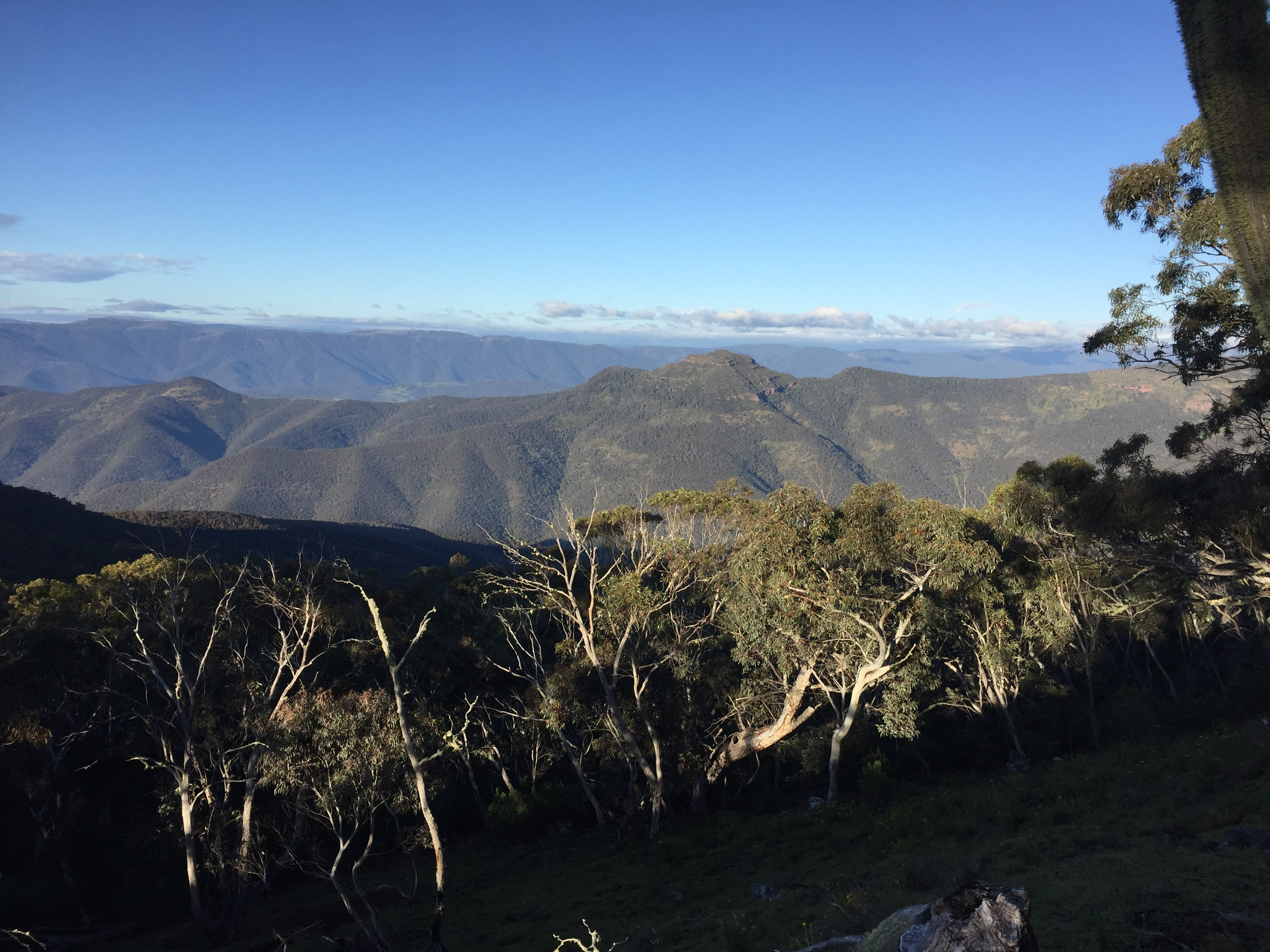
DAY 2
The next morning I was blessed with blue skies and amazing views across the Caledonia River and to the north. There were open faces stretching down towards the river and I’m sure in a remote and undisturbed place like this, with some time and patience, you would spot deer feeding well away from cover. Anyway photographing deer was not on my agenda on this trip so I kept moving.
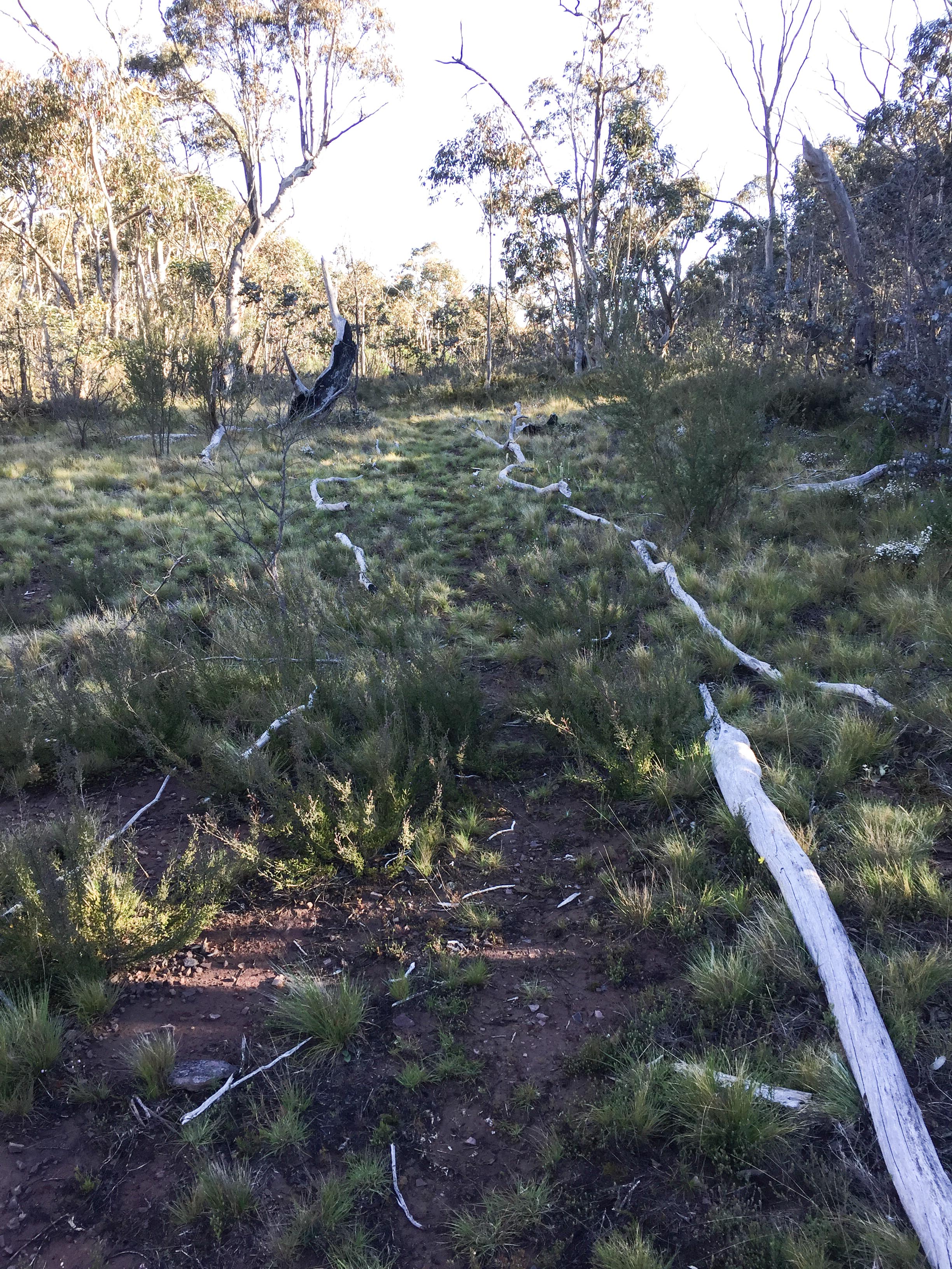
Persons before me had gone to lot of trouble placing piles of rocks at strategic locations along the route. These rock cairns were the only visible marking system along the section between Long Hill and the Rock Shelter. Occasionally I missed a few rock cairns and ended up on the worst part of the ridge soon realising there must be an easier way. I then retraced my steps until the last known cairn and did a brief search until I identified the next stack of rocks. I was thankful that whoever originally placed the rocks knew the best way to avoid the most difficult terrain. Sometimes the route dropped 20 metres down the side of the ridge and at other times it crossed the ridge at right angles to go from one side to the other side. When there was a shortage of rocks the path had been lined with dead branches!

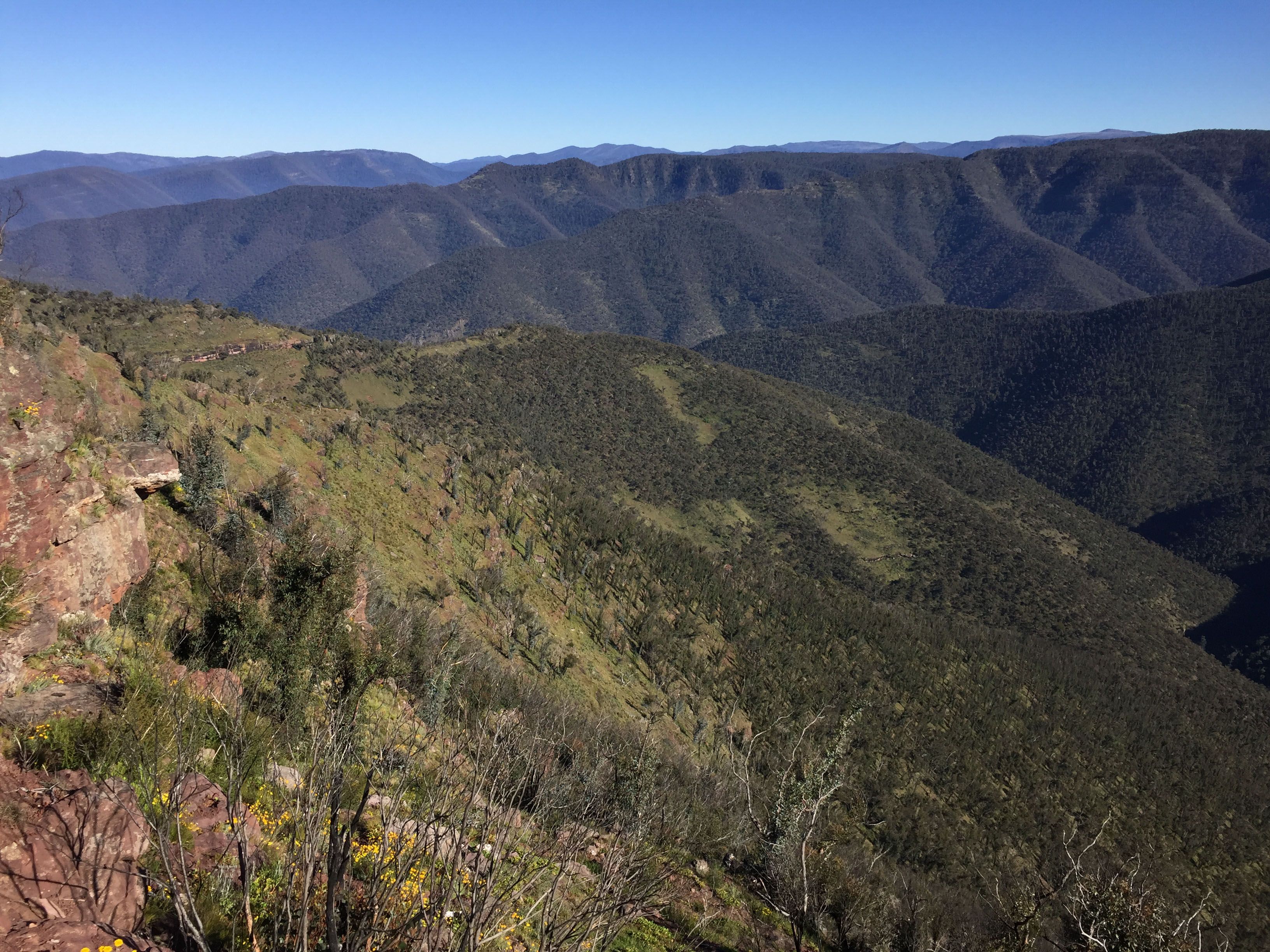
All the time there was a new inspiring view to look at. In contrast to the walk up to the Crinoline there were no unnatural blemishes in the distance such as cleared farmland. It was 9.15am and I was in one of the many saddles. What I thought was going to be an easy walk along a contour turned out to be a fair amount of up and down. I finally arrived at the Rock Shelter for a snack, drink and another fantastic view to the north. The trail was becoming more discernible and to my surprise a few hundred metres later it transformed into a 4WD track! Although there wasn’t much evidence of vehicle traffic I would have preferred a narrow walking track. Now for a steady climb towards Mt Tamboritha.

After what seemed like ages I had reached the next intersection, McMillans Track (elevation 1370m). This took me over Mt Tamboritha with views to Bennison Plains, and down to a saddle before Little Tamboritha. By this stage I had covered 30 km, and with a total ascent of 2000 metres no wonder my legs were feeling tired.
I was also thirsty. Looking at my water situation was disconcerting as I barely had enough to last another day? On the first night I had used a couple of litres and so far that day consumed the same again. At this rate I was going to run short. My options were to drop down a gully and hope I didn’t have to go too far, continue on and tough it out, or take advantage of a number of constructed fire dams situated along the track. I came across the first dam on the saddle between Mt Tamboritha and Little Tamboritha. This dam like the next two I encountered must have been constructed over a decade ago before an existing track was downgraded to a walking track. If it was good enough to sustain frogs it should be good enough to drink. Although it was not currently being fed by a stream it had obviously been flushed during the winter/ spring rains and was still reasonably clear. I took a couple of litres and boiled it before drinking just to be on the safe side. There were no side effects. The next time I will take a water filter.
It was my intention to cover some more ground to make it a shorter day tomorrow so I walked past the last dam and camped on a nice grassy top at 1260 metres. I had walked just over 18 kilometres that day.
DAY 3
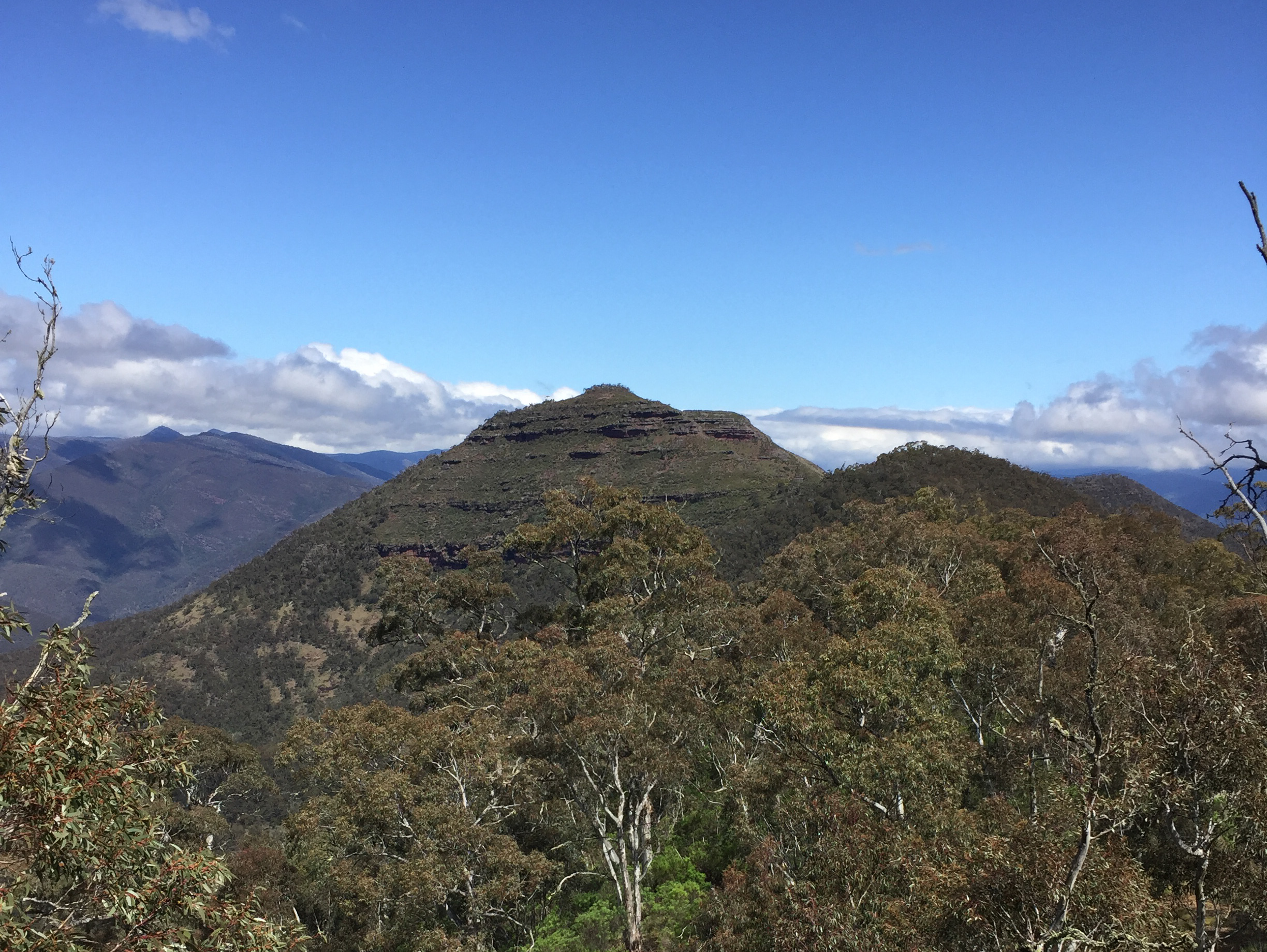
This was going to be a short day. The last seven kilometres was all downhill. Again there were very few markers with little or no track to follow. There was evidence there once was a track but it was now quite overgrown. One of the spurs was a bit tricky with a slight turn to the west before dropping off – if you went straight ahead you would have some bush bashing to do. With clear views across to The Crinoline so I could see where I had been two days earlier. Slowly I was descending and by looking in the distance I was able to compare my elevation with landmarks on Day 1. Leaving camp at 6.45 I arrived back at the car at 10am.
If you were really fit and didn’t mind pushing yourself you could do this walk in two days but personally I don’t think it would be enjoyable. It’s better to take your time and absorb the scenery and natural wonders. This walk is in remote country on mostly unconstructed tracks with limited marking. There is a fair bit of steep walking and uneven ground. This is a great walk for improving your level of fitness, planning and navigation skills combined with beautiful scenery. It had a bit of everything.

Hi Greg how are you mate. Have been looking through most of your high country photos. Particularly the areas like long spur, moroka river, the crinoline and vanjelo hut area as these are all places I have hunted and hiked. Awesome part of the world, your photos are pretty awesome mate. Just wondering if you still get into these places your self?
I was in love with long spur a while ago but seems to get pretty busy in there now, people leaving rubbish. It’s a shame. Probly one of the nicest places in the bush and somewhere I used to see an abundance of deer.
LikeLike
Hi Mark, thanks for your comment. I agree with what you are saying.
I haven’t been to the Long Spur since 2016. How time flies – I mix deer photography in with hiking, sea kayaking and other interests. Thinking back to my first trip, it was so impacting and gave me such an amazing experience. The first time I went to the Long Spur was 2010 at a time when not as many other hunters were backpacking in. Prior to then I was concentrating on the Moroka further downstream. As you mentioned it’s much different now. I too noticed more rubbish, especially high up along the spur. The last time I went there I observed other hunters as well. It’s not the ideal wilderness for seeing stags that it used to be. Word has got around that it was once the jewel of the high country! It’s also a physically and mentally demanding area to access which requires a fair amount of ability and commitment.
I picked up signs of a few deer on the Crinoline circuit too, but haven’t been back. These days you need to get at least a day’s walk away from the nearest road to stand a good chance of seeing an even ratio of stags to hinds.
It’s good to hear from someone who shares the same interests.
LikeLike
Hi Mark & Greg.
I am planning to walk in to The Crinoline or Long Hill and hunt for a couple of days. This will be my first overnight backpack adventure. Do you have any tips or any helpful info you could pass on with how to approach this walk in? Essentials, things to be aware of, what to use to map it like GPS, phone, maps etc. Thank you so much and look forward to you reply
LikeLike
Hi Barrie,
Thanks. It’s a great area. Obviously the most important thing is your safety. In terms of a Personal Locator Beacon – PLB. I use a Garmin inReach Mini (120g). This has a satellite text messenger feature as well as PLB.
For mapping and GPS navigation I use my mobile phone with Gaia GPS Premium.
Gaia GPS is a mapping and GPS navigation application for mobile devices The Gaia GPS map catalog (on the Premium plan) includes full topographic coverage for Victoria (1:25,000 scale). I found Gaia mapping and navigation better than Garmin GPS. Ensure that you take a portable battery charger for your phone and a spare cable. Leave phone on aeroplane mode when tracking to save battery. As a back up take a compass. If you have limited experience a hard copy of a map is also a good idea.
Carry lots of water in late Spring, Summer and Autumn. Water is hard to find when you are up high and on the tops in late Spring, Summer and Autumn.
Keep your pack weight to a minimum. Pack lightweight gear. A good lightweight three season tent. A first Aid kit. Ideally keep you pack below 14 kg for a multiday camp (excluding hunting items such as firearm, bullets, knife, bino’s etc). Use freeze dried/dehydrated food and latest lightweight materials. Be prepared for a change of weather.
Have a good trip.
LikeLike